Asakusa to the Skytree: The River Walk Your Map App Skips
Two of Tokyo's most famous landmarks sit about two kilometres apart. You can walk between them on a dusty main road—or spend the exact same hour crossing a hidden river bridge and strolling under railway arches.
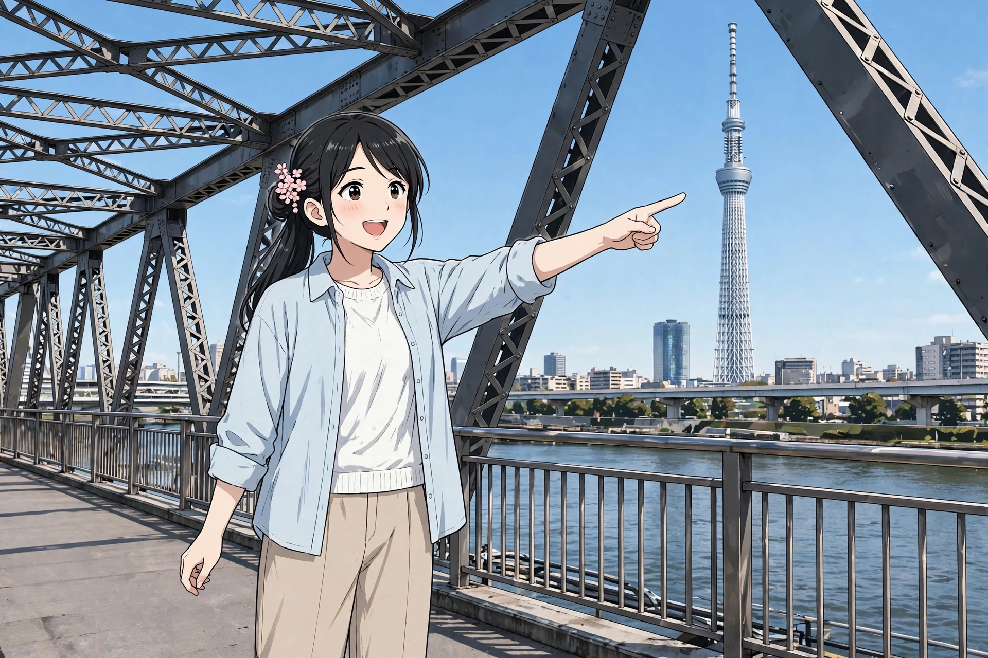
Sensō-ji Temple and Tokyo Skytree anchor two very different eras of Tokyo, separated by roughly two kilometres across the Sumida River. Navigation apps routinely point visitors down a busy main-road corridor, treating the distance between them as a blank gap to be crossed as quickly as possible.
Yet by shifting the route slightly north, that same hour of walking transforms into a continuous riverside stroll. It takes you past traditional market stalls, over a historical bridge, and beneath quiet elevated railway arches.
The short version
Two landmarks, the same ≈25 minutes of walking — the default route spends it on a traffic corridor; the curated route spends it on temples, a riverside park and a hidden bridge. Walk it north instead: Kappabashi's kitchen street (optional warm-up) → Kaminarimon's giant lantern and the Nakamise stalls → Sumida Park, with the Skytree across the water → the Sumida River Walk, a free pedestrian path attached to a 1931 railway bridge (7:00–22:00, glass floor included) → Tokyo Mizumachi's cafés under the arches → arrival beneath the 634-metre tower. Snacks: warm ningyo-yaki, Kagetsudo's jumbo melonpan, seven-strength matcha gelato (short spur), Ichiya's daifuku and dorayaki, and a tower-only matcha soft serve at the end. Toilets: three free anchors — start, Sumida Park, Skytree Town. Best start: early morning, or late afternoon for the tower lights.
Open the default route in Google Maps Open the curated River Walk route in Google Maps
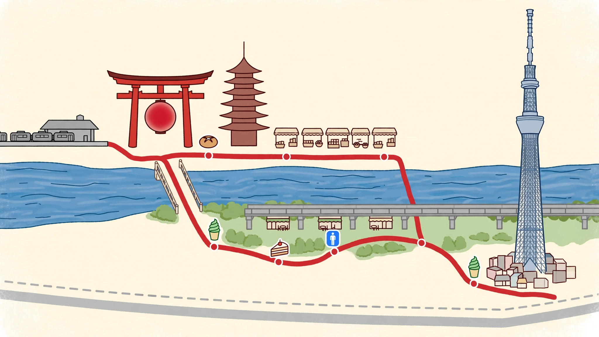
The default route — what your map app gives you
From Asakusa, standard navigation apps recommend a direct line along the main-road corridor roughly paralleling the Tobu line. This covers an estimated distance of about 2 km and takes an estimated 20 to 25 minutes of continuous walking.
While efficient, the default path consists primarily of asphalt pavement alongside heavy vehicular traffic, mid-rise office buildings, and convenience stores. The river is crossed on a standard road bridge or missed entirely. Both iconic sights get checked off the list, but the space between them remains a blank experience.
Open the default route in Google Maps
Kappabashi: the kitchen street (an optional warm-up)
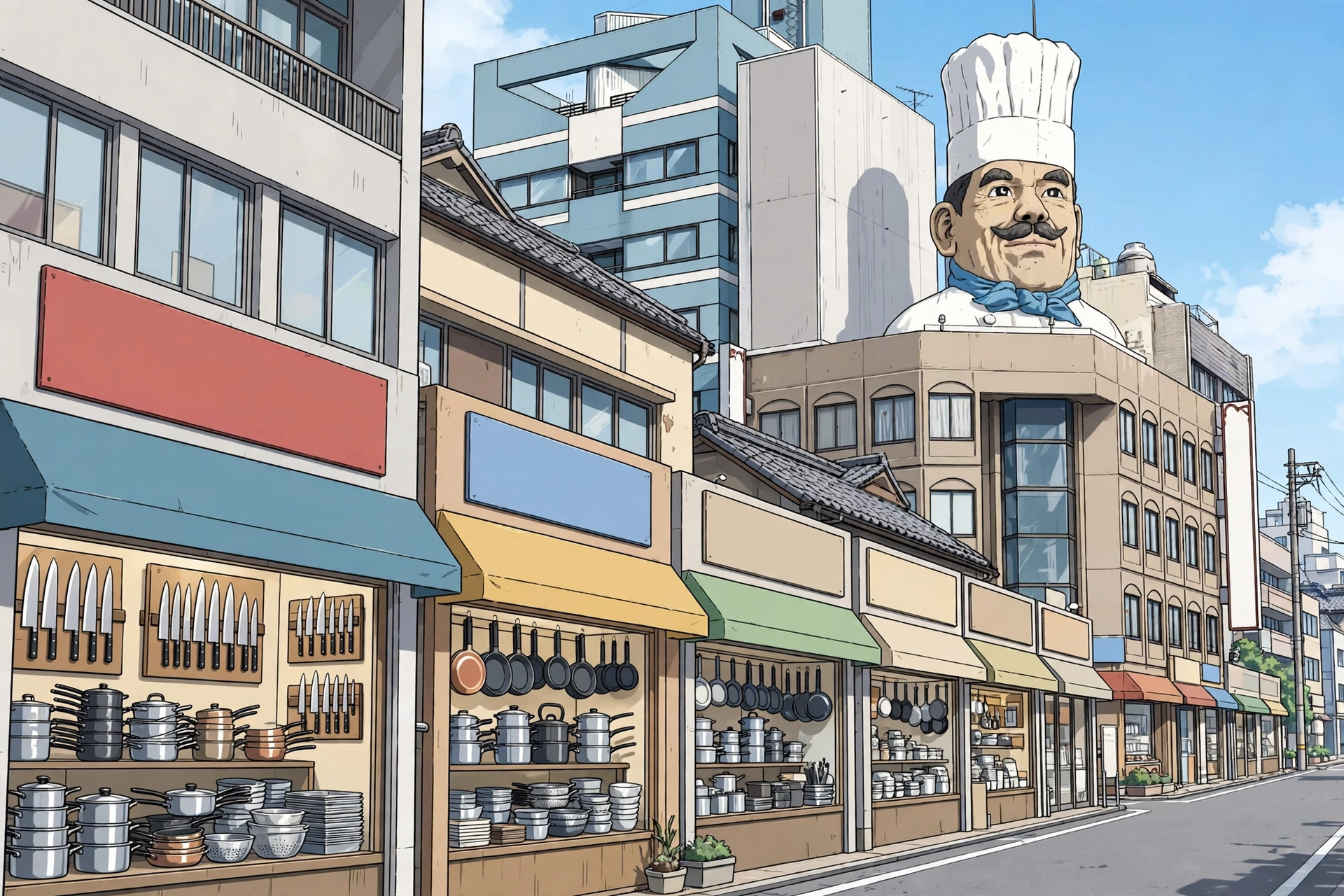
Before heading toward the river, an optional warm-up begins slightly west of Sensō-ji at Kappabashi. Known as Tokyo's kitchenware wholesale street, this district is marked by a giant chef's head landmark perched on a corner rooftop.
Tokyo's restaurant operators source their knives, pots and specialised cooking tools here. It serves as a practical stop for souvenir hunting, particularly for cooking enthusiasts interested in specialized utensils or realistic display food samples.
Open the curated River Walk route in Google Maps The full walk in this article, waypointed via Kappabashi, the Sumida River Walk and Tokyo Mizumachi.
Kaminarimon and Nakamise: the temple approach
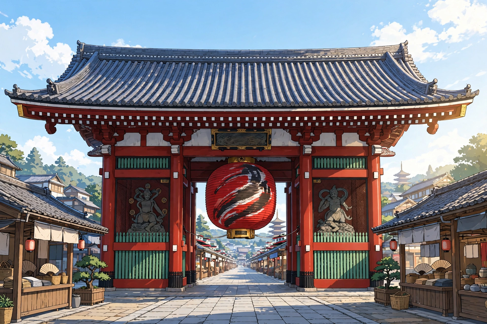
The core walk begins at Kaminarimon ("Thunder Gate"), the grand outer entrance to Sensō-ji, Tokyo's oldest temple precinct. Suspended directly beneath the gate's timber frame is a giant red paper lantern that marks the historic entrance to Asakusa.
Beyond the gate stretches Nakamise, a historic shopping street lined with small shops selling traditional snacks, folding fans, and crafts. The street leads directly to the main hall of Sensō-ji. Setting out in the early morning or early evening allows visitors to experience the temple architecture with fewer crowd bottlenecks.

Detours & comfort
The Guide's snack stops — and, further down, the route's toilet anchors. The small certainties that make an hour's walk easy.
Warm ningyo-yaki — small sponge cakes baked in moulds shaped like dolls, lanterns and pagodas — are sold warm from stalls all along Nakamise itself. Buy one and eat it standing beside the shop: in Asakusa the custom is to eat where you bought, not while walking, and the shop will take the wrapper back.
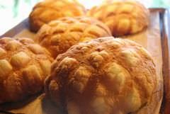
Kagetsudo — the melonpan detour
Two minutes west of the main hall, on the Nishi-Sandō shopping street: an oversized, crackle-topped melonpan, a few hundred yen at the counter — the bun people cross the city for. Usually about 9:00–17:00, but the shop closes when the day's batch sells out, often by mid-afternoon. A second counter stands about a minute from Kaminarimon itself.
Photo: the shop's own jumbo melonpan, straight off the tray. Photo: Kagetsudo official site.
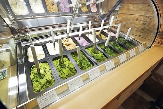
Suzukien — seven strengths of matcha (optional spur)
Behind the main hall, a short there-and-back detour reaches a tea wholesaler's gelato counter serving matcha gelato in seven intensity grades. The strongest, No. 7, is billed as the world's most concentrated matcha gelato. A few hundred yen a cup; open late morning to 17:00, with irregular closures announced on the shop's social channels.
Photo: the shop's own gelato case — the greens deepen left to right through the seven strengths. Photo via Enjoy Tokyo's spot page for the Suzukien × Nanaya shop.
— The Guide: Start at the gate, end under the tower — the river does the middle.
Sumida Park: the tower across the water
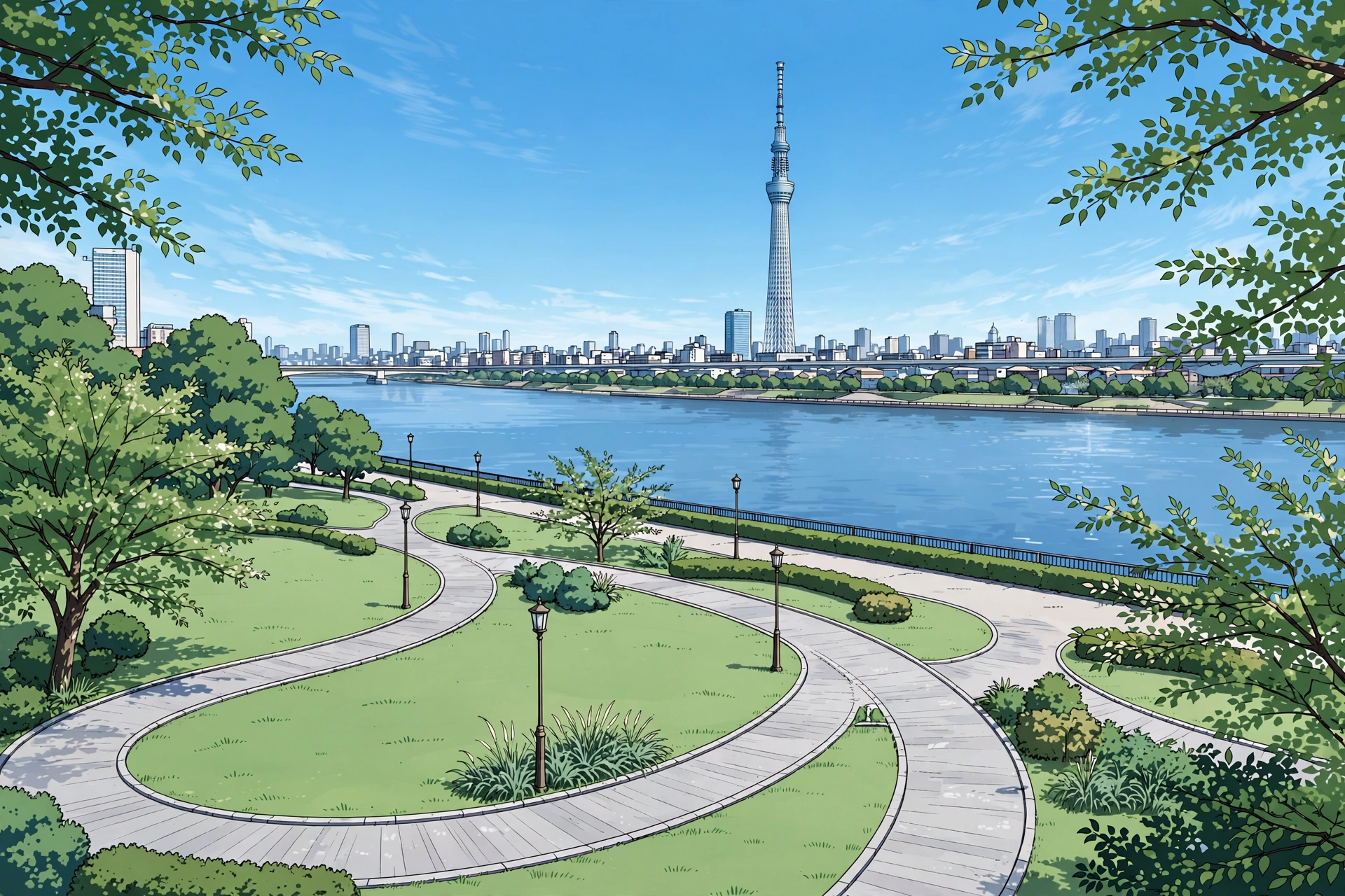
Leaving the temple grounds and walking east brings you to the west bank of the Sumida River and Sumida Park.
This riverside park provides a classic postcard view: Tokyo Skytree framed directly across the wide water, giving a clear sightline of your ultimate destination while the tower still sits across the river.
The park also carries the route's midpoint comfort anchor: its toilet blocks — several of them, on both banks, including by the park information centre — are free and never more than a few minutes off the path (details in Practical planning).
The Sumida River Walk: the bridge most people miss
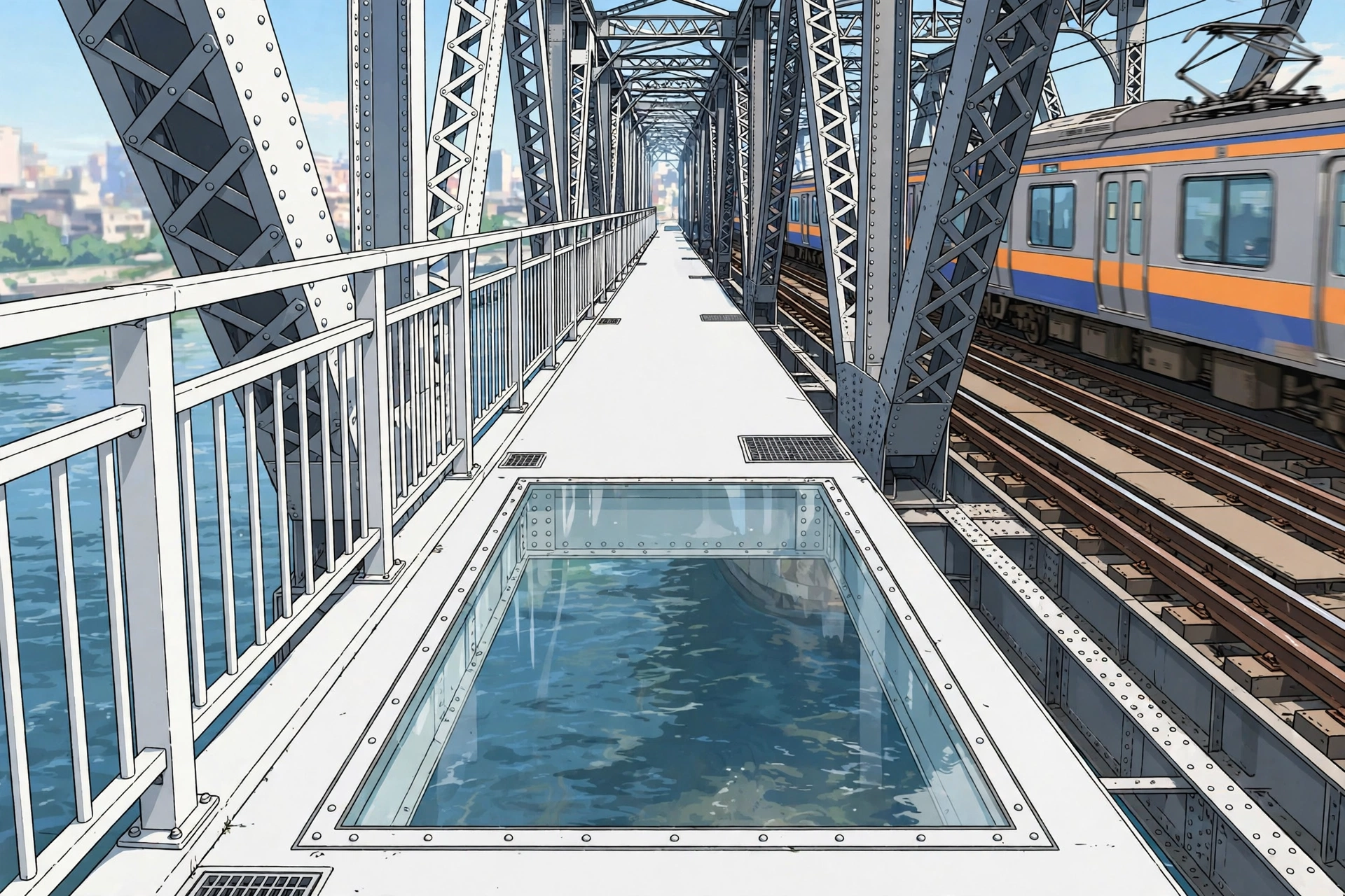
The central hinge of this route is the Sumida River Walk, a dedicated pedestrian path opened on 18 June 2020. Rather than constructing an entirely separate bridge, engineers attached a ≈160-metre-long, 2.5-metre-wide walkway onto the south side of the Tobu Skytree Line's Sumida River Bridge—a steel railway truss bridge originally completed in 1931.
Painted in "Skytree White," the bridge's nighttime illumination is coordinated with the tower itself. As you cross, Tobu line trains rumble past at arm's length on the adjacent tracks. A glass-floor section built into the walkway allows pedestrians to look directly down at the river surface and passing boats.
The walkway is completely free of charge and operates daily from 7:00 to 22:00. Because its entrance sits quietly beside the rail line on the Asakusa side, many visitors walk straight past it.
Tokyo Mizumachi: coffee under the arches
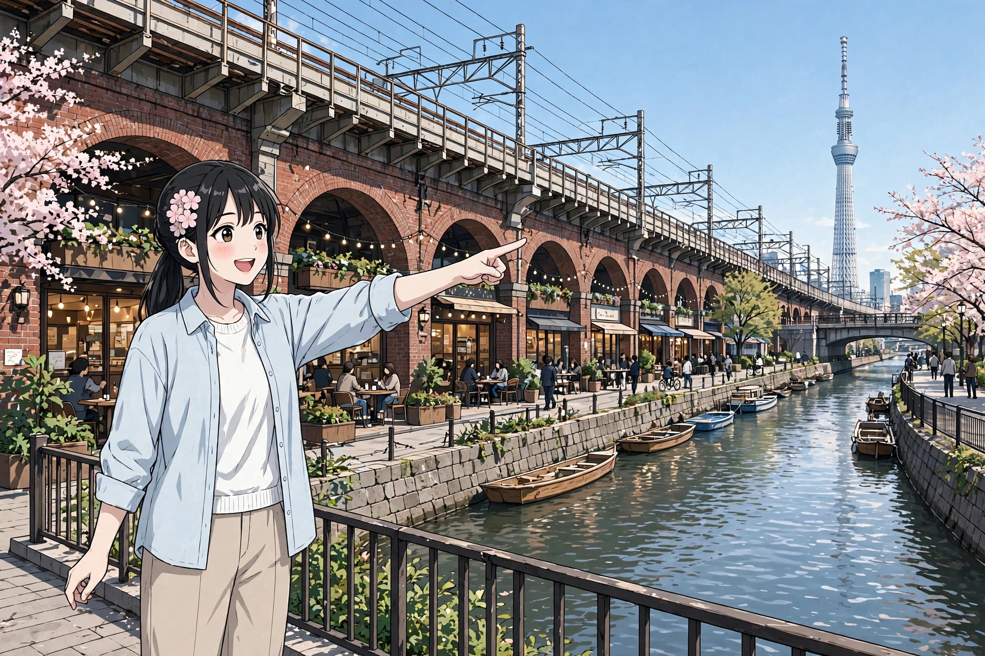
Stepping off the pedestrian bridge on the east bank leads directly into Tokyo Mizumachi. Opened in stages starting 18 June 2020, this commercial strip sits beneath the Tobu Skytree Line viaduct along the banks of the Kitajikken River, beside Sumida Park on the east bank.
The area repurposed the space under the elevated railway arches into a precinct of small shops, open-air cafés, and a hostel. In an intentional design detail, the complex stretches ≈634 metres end to end—matching the exact numeric height of Tokyo Skytree rising overhead.
The mid-route sweet stop is built into the arches: Ichiya, a wagashi shop from nearby Hikifune, makes daifuku and dorayaki by hand — five standard varieties of each, plus seasonal specials — with a small eat-in corner for matcha drinks and anmitsu (open 10:00–18:00, last orders 17:30; closed Tuesdays). If its queue is long, the bakery café Muuya, a few doors along, serves cube-shaped shokupan loaves and French toast instead.
Both double as the route's midpoint rest. Tokyo Mizumachi has no public toilet block of its own — its toilets are inside its cafés and shops, for customers — and Sumida Park's public blocks stand just outside, on this bank too.
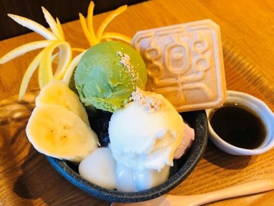
Ichiya — daifuku & dorayaki, under the arches
Handmade daifuku and dorayaki in Tokyo Mizumachi's West Zone, with a small eat-in corner — the route's mid-point rest as well as its sweet stop. 10:00–18:00 (last orders 17:30), closed Tuesdays.
Photo: the eat-in side of the counter — Ichiya's sweet bowl with its stamped monaka. Photo: Tokyo Mizumachi official shop list.
Arrival in Oshiage: the tower, earned
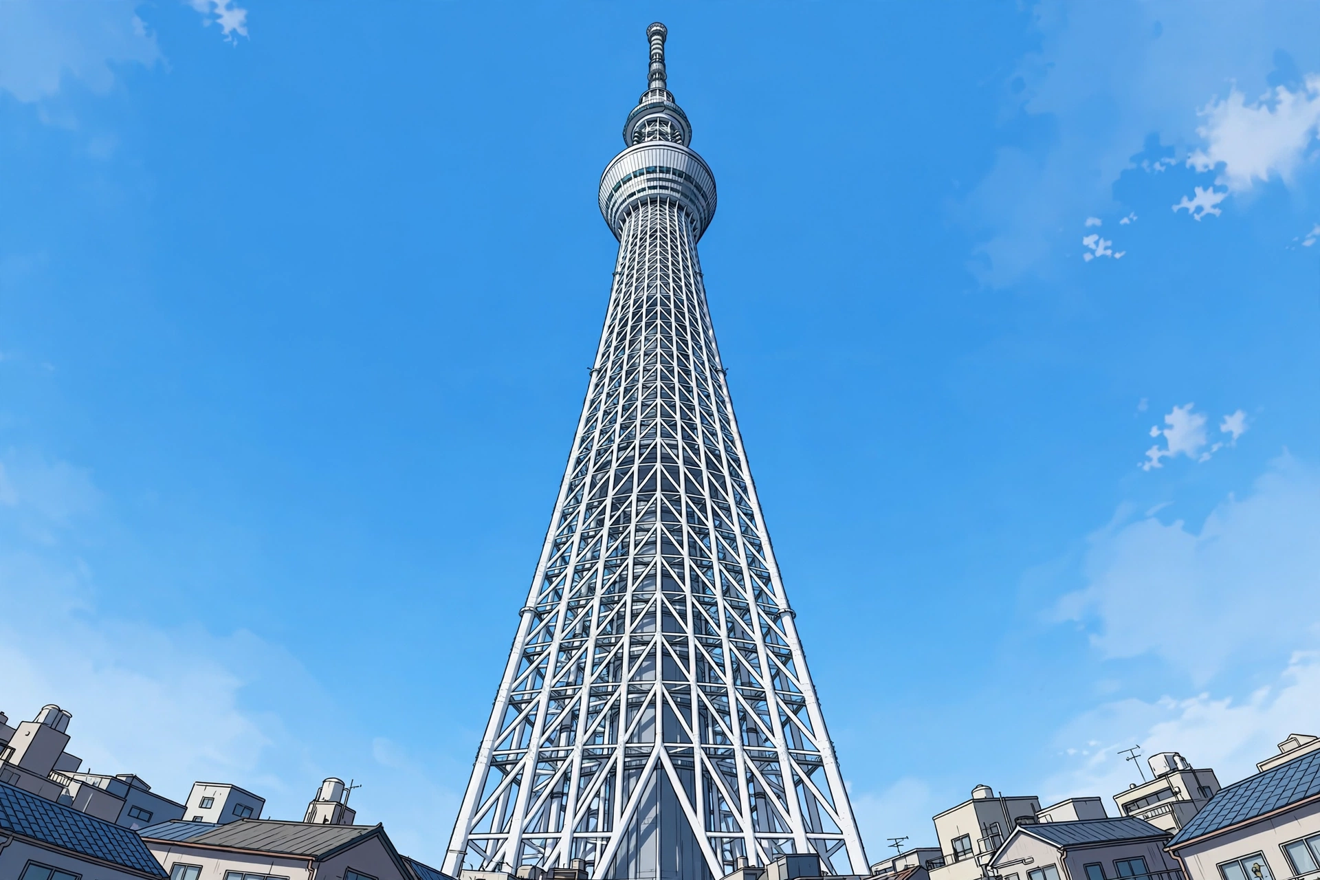
Instead of emerging abruptly from a subterranean subway exit, following the Mizumachi corridor allows Tokyo Skytree to grow steadily in view until you arrive directly beneath its steel structure in Oshiage.
Officially opened on 22 May 2012, Tokyo Skytree stands 634 metres tall, certified by Guinness World Records as the world's tallest free-standing tower. The height number 634 is pronounced Musashi in Japanese wordplay, referencing the historic province that anciently encompassed the area. At its base sits Tokyo Skytree Town and the Solamachi commercial center.
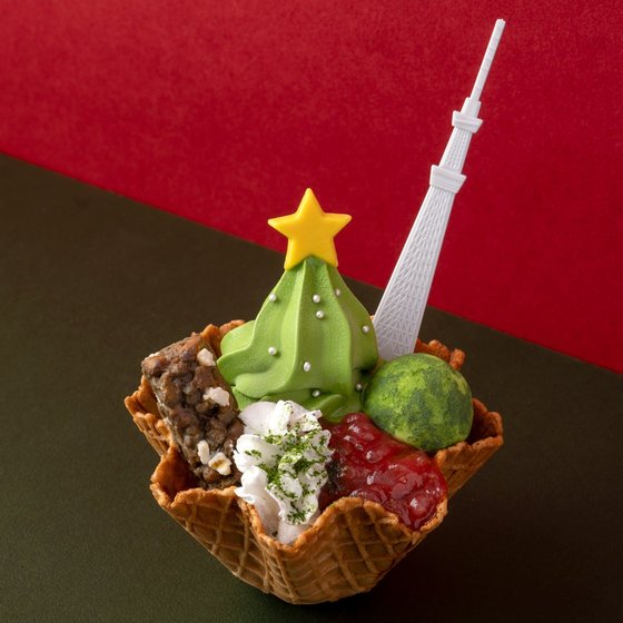
Gion Tsujiri — the arrival reward
On Solamachi's 6th floor, the Kyoto tea house serves the “Tsujiri Tree Soft” — a matcha soft serve made for this tower and sold only at this shop. The reward at the end of the walk. Floor open 11:00–23:00; soft-serve orders end at 21:45.
Photo: the shop's own Tree Soft — the matcha soft serve and its Skytree spoon, in the Christmas-season version. Photo: Gion Tsujiri official release.
The two walks, side by side
| Feature | Default Main-Road Route | Curated River Walk Route |
|---|---|---|
| Primary scenery | Traffic, office blocks, convenience stores | Temples, riverside park, historic rail bridge, archways |
| Walking distance (estimate) | ≈2.0 km | ≈1.9 km (core) / ≈3.5 km (with Kappabashi) |
| Pure walking time (estimate) | ≈20–25 min | ≈25 min (core) / ≈50 min (with Kappabashi) |
| Total budgeted time (estimate) | ≈20–25 min | ≈1.5–2.5 hours (with stops) |
| Terrain & Access | Flat, paved sidewalk | Flat, step-free, wheelchair accessible |
The curated river route requires virtually no extra walking distance compared to the standard main road. It spends the same estimated 25 minutes of active walking time, but trades vehicular traffic for historic gateways, river views, and shaded archways.
Practical planning
- Best time of day: An early morning start provides a quiet walk through Nakamise before shop shutters open fully. Alternatively, a late afternoon start allows your crossing on the Sumida River Walk and arrival at Tokyo Skytree to align with the evening illumination. (Note that the Sumida River Walk gate closes at 22:00).
- Accessibility: The curated walk is flat and step-free throughout, and the River Walk itself is wheelchair accessible.
- Tokyo Skytree admission: Skytree admission uses variable pricing based on the date of travel. Checked against the official website on 7 November 2026, advance online tickets for the Tembo Deck (350 m) start at ¥1,800 for adults (ages 15+) and from ¥900 for children (ages 6–14); children aged 5 and under enter free. A combination ticket covering both the Tembo Deck and the higher Tembo Galleria (450 m) starts at ¥3,000 for adults and ¥1,500 for children. Purchasing tickets in person at the 4th-floor counter or ticket machines adds a ¥500 service fee per ticket, so booking online before setting out is recommended.
- Route links (Google Maps, walking mode): Default route Curated River Walk route The distances and times in this article are estimates; opening either link shows the live walking distance and time in Google Maps.
- Navigation & Luggage: The River Walk entrance on the Asakusa side sits close to the railway structure and is easily overlooked on standard maps. Having a working map pin ready is helpful. To enjoy the pedestrian bridge and market stalls comfortably, consider traveling hands-free.
Toilets on this route
Start: Asakusa Culture Tourist Information Center (opposite Kaminarimon, 9:00–20:00) · Midpoint: Sumida Park, both banks (several blocks, incl. by the park information centre) · Destination: Tokyo Skytree Town (every floor). All free — and the cafés and sweet shops in Tokyo Mizumachi have customer toilets if you're stopping anyway. The start and destination anchors include barrier-free toilets.
Using a Japanese toilet: the bidet seat's three buttons are おしり (oshiri — rear wash) · ビデ (bidet — front) · 止 (stop). Toilet paper is provided, and it is flushable.
Carry a small hand towel — many restrooms have no paper towels, and locals carry their own. A tenugui hand towel doubles as a souvenir.
Plan this trip
- Read our complete guide to luggage in Japan — the 160 cm rule, forwarding and lockers to locate storage options before walking.
- Stay connected while navigating city walkways with our Japan eSIM comparison.
- Explore regional craft items found around Nakamise and Kappabashi in our guide to buying souvenirs in Japan by where you live.
Sources
- Kajima Corporation — Architectural design and construction specifications for the Sumida River Walk bridge attachment (accessed 7 November 2026).
- GO TOKYO (Tokyo Official Tourism Website) — Precinct profile and operational information for Sumida River Walk and Sumida Park (accessed 7 November 2026).
- Tobu Railway Co., Ltd. — Official press releases regarding Tokyo Mizumachi development and Sumida River Walk opening (accessed 7 November 2026).
- Tokyo Skytree Official Site — Technical specifications, historical opening date, and admission fee structures (checked 7 November 2026).
- Reference cross-checks — Tokyo Skytree height, opening date and Guinness "world's tallest free-standing tower" certification (accessed 7 November 2026).
- OpenStreetMap Data — Spatial mapping and pedestrian distance measurements for Asakusa, Sumida River Walk, and Oshiage (accessed 7 November 2026).
- Mappu / Japan Nakama — OpenStreetMap-based route measurements behind the walking-distance and walking-time estimates in this article (accessed 7 November 2026).
- Google Maps — Directions links for both routes on this page, built with the Google Maps URL API in walking mode (added 7 November 2026); opening a link shows the live distance and time for that route.
- Walker-comfort sources (checked 7 November 2026) — Taito City official pages (Asakusa Culture Tourist Information Center facilities; Sumida Park, Taito side); Sumida City official park page (Sumida Park, Sumida side); Tokyo Solamachi and Tokyo Skytree official floor guides (toilets; Gion Tsujiri, 6F); Mapple facility guide for Tokyo Mizumachi (customer toilets; no standalone public block); shop listings via Jalan, Tabelog, OZmall and Enjoy Tokyo for Kagetsudo, Suzukien, Ichiya and Muuya. Shop prices are deliberately not quoted — they appear only on each shop's own current menu. Snack photographs: licensed stock via Pexels, credited on each card.
Advertising disclosure. This page contains affiliate links — advertising. If you buy through a link on this site, we may earn a commission, at no extra cost to you. Prices and conditions shown here were checked against the providers' official pages on the dates stated and may have changed since. This site is a research desk: everything here is compiled from publicly available information, not from personal use, and nothing on this page is a personal endorsement based on first-hand experience.